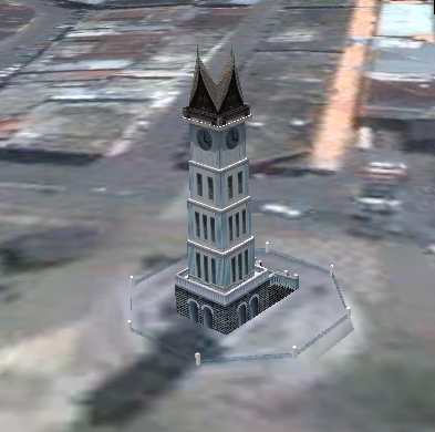
jam gadang big clock tower in Bukittinggi, as shown in google earth Bukittinggi means in Indonesian language "high hill" is one of the larger cities in West Sumatra, Indonesia, which is 90 km by road distance from the West Sumatran capital city of Padang. It is having a population of over 91,000 people and an area of 25.24 km². It is a city popular with tourists due to the climate and easy accessibility. Attractions within and around the city follows: Nearby Tourist attractions include Lake Maninjau and the Harau Valley. Google Earth 3d view/ satellite map view/hybrid satellite maps/road map of Bukittinggi, Indonesia Location of Bukittinggi,Jam Gedang,Lobang Jepang (Japanese Caves),Ngarai Sianok (Sianok Canyon),Taman Bundo Kanduang park,Museum Rumah Kelahiran Bung Hatta in Indonesia map Location of Bukittinggi,Jam Gedang,Lobang Jepang (Japanese Caves),Ngarai Sianok (Sianok Canyon),Taman Bundo Kanduang park,Museum Rumah Kelahiran Bung Hatta in World map (These are tourist attractions of Bukittinggi)
Tags: Bukittinggi |
|||