asia |
Image of Strait of Hormus, Iran* Straße von Hormus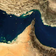 * Images courtesy Flickr.com and its vibrant members Google Earth 3d view/aerial satellite map view/hybrid satellite maps/road map of Strait of Hormuz, Iran follows |
|||
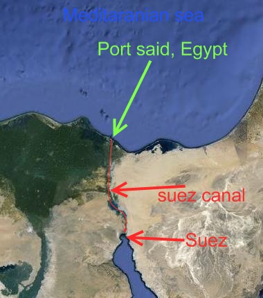
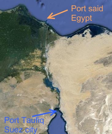
The Suez Canal is an artificial sea-level waterway connecting the Mediterranean Sea and the Red Sea located in Egypt. Opened on November 1869, it allows shortest water transportation between Europe and Asia avoiding the requirement of navigating around Africa. The northern terminus is Port Said and the southern terminus is Port Tawfik at the city of Suez. Suez canal map |
|||
|
|||


