bali |
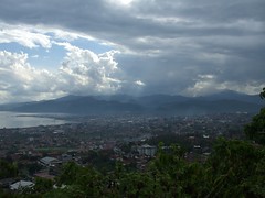
Lampung is a province of Indonesia, located on the southern tip of the island of Sumatra. which borders with provinces of Bengkulu and South Sumatra. Lampung name come from the "Lampung" tribe, who speak a distinct language from other people in Sumatra and have their own alphabet. A large portion of the current population of Lampung is descended from migrants from Java, Madura, and Bali. Lampung is often heard for its earthquakes and volcanoes. On May 10 2005, a strong earthquake measuring 6.4 on the richter scale struck the province. The historical volcano blast of Krakatau occurred in 1883, which resulted in disastrous consequences.
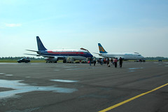
TGK Air Port Lampung |
|||
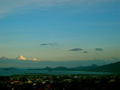
Bali is a nice island in Indonasia famous as a nice tourist destination. |
|||
Google Satellite maps of Indonesia |
|||

