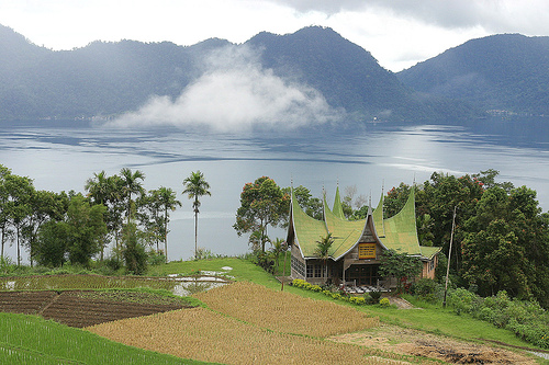
Lake Maninjau in Indonesian language called Danau Maninjau, means overlook or observation is a caldera crater formed lake in West Sumatra, Indonesia. It is 16 km near to the city of Bukittinggi in Sumatra. It is estimated to have formed 50000 years ago and has 20x8 km length and width.People who live are mostly ethnic Minangkabau.Lake Maninjau is used for hydro electric power generation and has aquaculture farm production. Lake Maninjau is big tourist attraction in the region because of its splendid scenic beauty. Sport activities like trekking paragliding attracts adventurists too. Google Earth 3d view/ satellite map view/hybrid satellite maps/road map of Lake Maninjau. Location Lake Maninjau, Indonesia in World map Tags: Indonesia |
|||


